This article will show how to download data from an area. These can be key attributes, the geography contained within the area, or points of interest.
Prerequisites
- You need to be logged into Vision.
- You need to have exporting permissions.
Estimated time: Up to 5 minutes.
Getting started
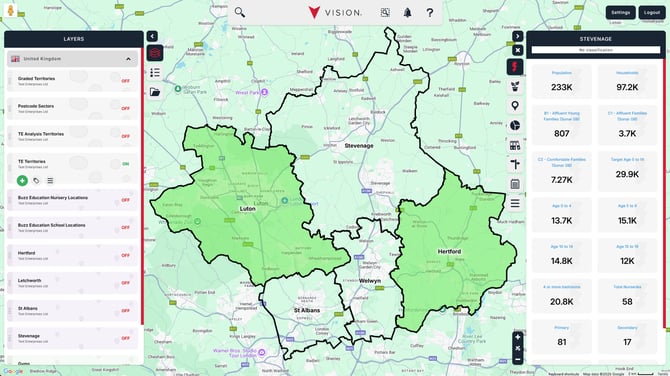
Turn on the layer the area is held in and select the area so the information window appears on the right.
Select the Actions tab.
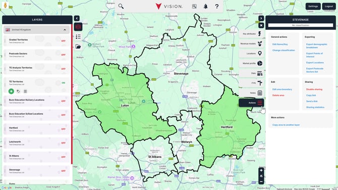
Exporting options
There are four options to choose from.

Export demographic breakdown - This provides a list of the base-layer geography in the area, along with the demographic attributes attached to the area layer.
Export Points of Interest - This exports the locations for any Points of Interest collections in your system that are contained within the area boundary.
Export Locations - This exports a list of locations from any of the location layers in your system that are within the area boundary.
Note. These can also be downloaded via the Locations tab by hovering over the data set and clicking on the Export locations in this area icon that appears on the right-hand side.

Export Base Area list - This will provide a list of the base-layer geography. The example provided is Postcode Sectors. If you've used a different geography, like Wards, 5-Digit ZCTAs, or a hierarchical layer like another area layer, it will identify the used geography and what can be exported.
After selecting one of these options, you'll see a window that may provide an option to download specific data, a choice to download a file, or copy to clipboard.
Downloading a file provides the data in an Excel format. Perfect if you need to interrogate the data or pass it on to other departments.
Copy to clipboard copies the data to your clipboard for pasting elsewhere. This is particularly useful for putting the data into a format other than Excel, like Word or PowerPoint.
Export demographic breakdown

What level would you like your data? This option will mainly be based on your chosen base-layer geography. You may have a secondary layer that you can export data from, if your layer is created from a hierarchical layer, like a Region layer that has been created from combining territories. Select the dropdown menu and choose the geography you'd like to receive the data for.
Export Points of Interest

Which POI collection would you like to export?
Select the dropdown menu to choose the POI collection you'd like to export. You can only export one POI collection at a time.
Export Locations

Which location layer would you like to export?
Select the dropdown menu to choose the location layer you'd like to export. You can only export one location layer at a time.
Export Base Area list

Simply choose how you would like to export your data and click Export.